
Turkey National Geodesy Commission Symposium at ÇOMÜ
The 24th Symposium of the Turkish National Geodesy Commission was held at the Troia Cultural Center, hosted by Çanakkale Onsekiz Mart University (ÇOMÜ). The strength of the science of geodesy in combating climate change and natural disasters was discussed…

0
A+
A-
The 24th Turkey National Geodesy Commission Symposium, hosted by Çanakkale Onsekiz Mart University (ÇOMÜ), was held at the Troy Cultural Center.
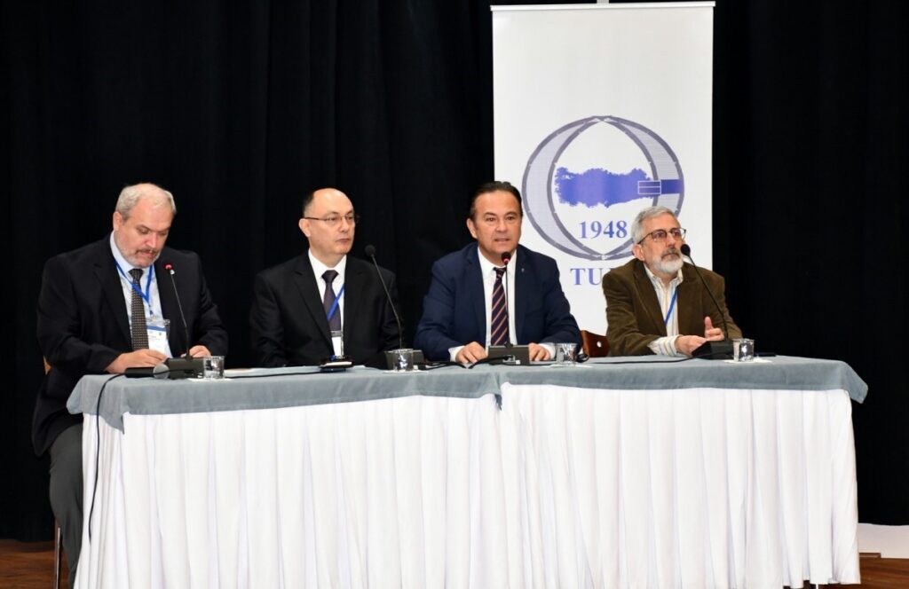
The event, which addressed the strength of the science of geodesy in combating climate change and natural disasters, was attended by Çanakkale Deputy Governor Mustafa Özsoy, President of the Turkish National Geodesy and Geophysics Union and General Director of Mapping Lieutenant General Dr. Osman Alp, ÇOMÜ Rector Prof. Dr. R. Cüneyt Erenoğlu, President of the Turkish National Geodesy Commission Dr. Eng. Col. Erdinç Sezen, ÇOMÜ Vice Rectors Prof. Dr. Evren Karayel Gökkaya, Prof. Dr. Hüsnü Levent Dalyancı, Acting Secretary General Oğuz Ünal, Kepez Mayor Birol Arslan, President of the Chamber of Surveying and Cadastre Engineers Ali İpek, Dean of the Faculty of Engineering Prof. Dr. Özgün Akçay, representatives from Çanakkale Protocol, academic and administrative staff, and students.
The program started with a moment of silence and the reading of the National Anthem.
Turkey National Geodesy Commission 2024 Organizing Committee President and ÇOMÜ Rector Prof. Dr. R. Cüneyt Erenoğlu noted that this year’s symposium theme was determined as “Geodesy in Monitoring Climate Change and Natural Disasters,” stating, “The technical knowledge and data possessed by the field of geodesy are vital for finding solutions to the climate change, disaster risks, environmental, and social problems our world faces. I believe this symposium will provide us with a broad perspective by addressing new scientific developments and applications in monitoring climate change and disasters. The TUJK 2024 Symposium will include presentations and discussions on a wide range of topics from geodesy’s reference coordinate systems to the gravity field, crustal movements, positioning, and satellite-based measurement techniques. In particular, the special session on climate change and natural disasters will address disasters that are effective in our country and around the world and the role of geodesy in disaster management, providing an effective sharing environment that will help us advance our knowledge and expertise. The technical knowledge accumulation of the science of geodesy is a discipline that directly impacts not only the academic world but also public policies and the quality of life of society. I believe that the ideas and projects that will emerge from the TUJK 2024 Symposium, which is part of our efforts to develop the science of geodesy in our country and effectively utilize this knowledge for the public good, will contribute significantly to both our university and our country,” he said.
The President of the Turkish National Geodesy Commission Dr. Eng. Col. Erdinç Sezen defined the concept of geodesy, emphasizing that geodesy is the most fundamental building block of geographic information systems and that any project and research conducted in the field of geodesy is extremely valuable for the country’s cartography, adding: “The scientific meetings of the Turkish National Geodesy Commission (TUJK) are goal-oriented. Due to their high scientific levels, they have always had a different and special place among geology-related meetings held in our country. On the other hand, they have provided an opportunity for people passionate about earth sciences to come together, get to know each other better, and form new collaborations. The TUJK Scientific Meetings, which we have held every year since 2002, have materialized with your efforts and our coordination as a presidency. I would like to state that the activities carried out have been conducted with great effort and dedication under the coordination of our working group heads and organizing committee members. I thank the Rector of Çanakkale Onsekiz Mart University and Organizing Committee President Prof. Dr. R. Cüneyt Erenoğlu, the organizing committee members, and everyone who contributed to this event,” he said.
The President of the Turkish National Geodesy and Geophysics Union and General Director of Mapping Lieutenant General Dr. Osman Alp emphasized the importance of cartography in a country like Turkey, which is in an earthquake zone, reminding that 24 years have passed since the beginning of the 21st century, stating, “The topic of this symposium is geodesy in monitoring climate change and natural disasters. We are closely related to the Earth’s rotation around its axis, polar movements, and crustal movements. Without geodesy, we cannot calculate the coordinates of a dynamic structure like the Earth’s surface. Geodesy is related to geology, geophysics, and the climate sciences that come to mind. Therefore, the impact of geodesy is significant. There is no longer a discipline or scientific field that begins here and ends there. Regardless of how complex it is or how it relates to other disciplines, everything needs to be processed together. However, one cannot exist without the other,” he noted.
After the presentation of gifts and plaques at the Turkey National Geodesy Commission Symposium, the program continued with a panel titled “Geodesy in Monitoring Climate Change and Natural Disasters.”
The opening program of the Turkey National Geodesy Commission Symposium concluded with a group photo.
Related Posts
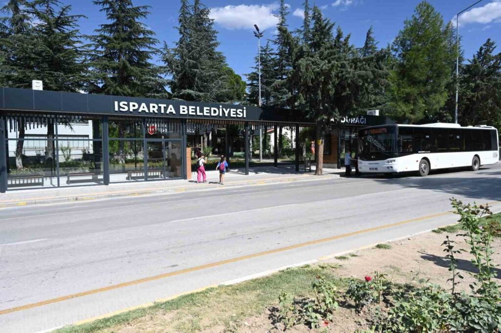
Isparta Municipality has renovated the bus stop located under the old bus terminal, which is frequently used by students and citizens, making it modern and air-conditioned. Faruk Daşdöner, the President of the Isparta Private Public Bus Cooperative, stated that the bus stop has been modernized ...
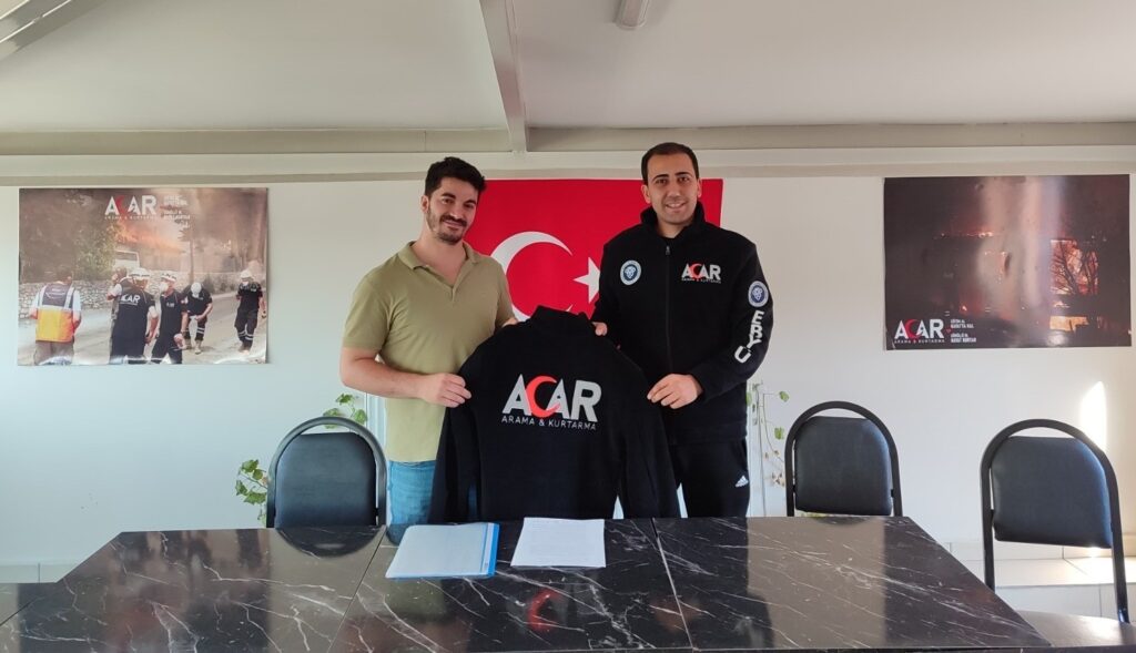
The Erzincan ACAR Youth Club, consisting of volunteer students within EBYÜ, has reached the final stages of establishing the ACAR Search and Rescue Youth and Education Association. The founding president, Ferhat Kılıçlı, stated that the work on the bylaws and management has been completed...
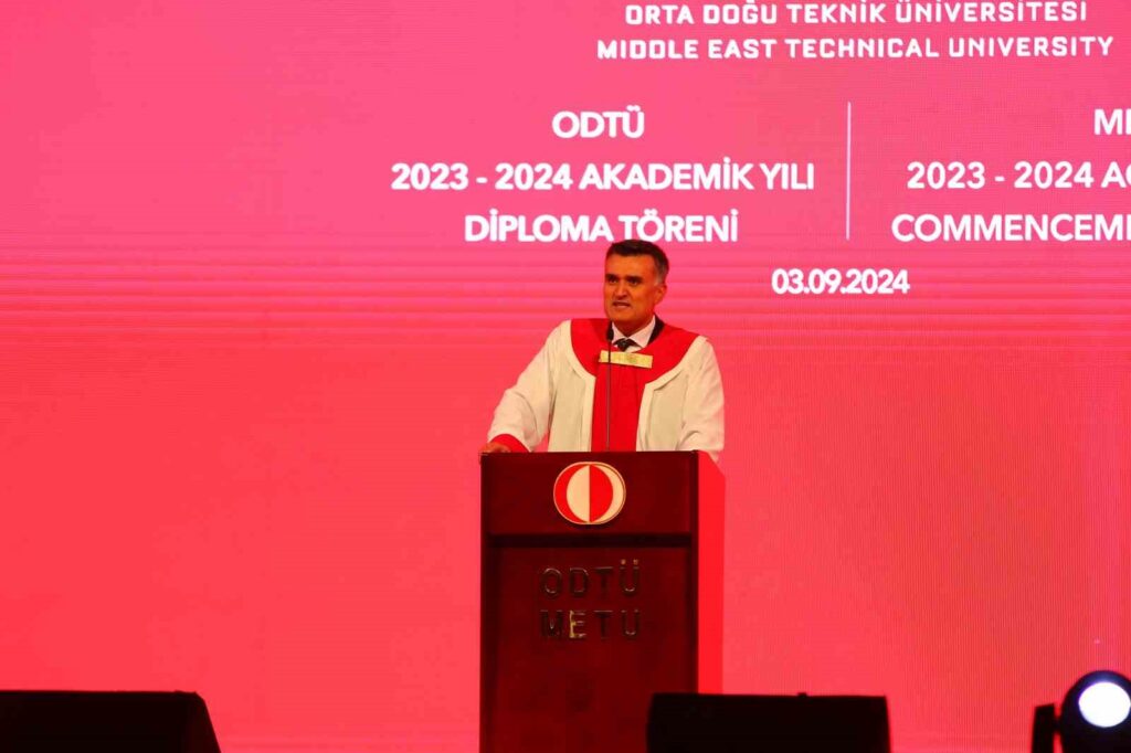
Middle East Technical University (METU) held its graduation ceremony for the 2023-2024 academic year at the METU Stadium. While METU Rector Prof. Dr. Ahmet Yozgatlıgil was delivering his speech, the electricity was cut off on stage...
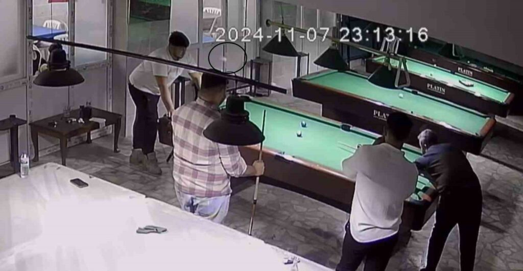
A young man was slightly injured when a billiard ball hit his head as he was playing billiards in Hatay. During the invisible accident, the moment the ball hit Beyazıt Geçin's head and his friends burst into laughter was captured on camera ...
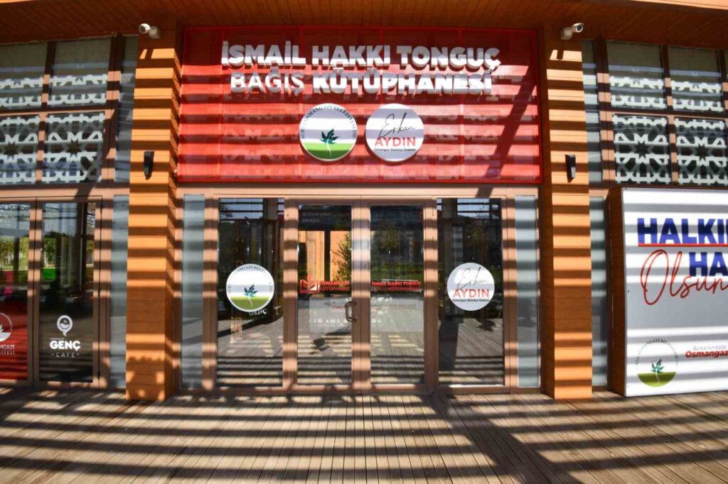
The 14th library brought to the city by Osmangazi Municipality, the Ismail Hakkı Tonguç Donation and Poetry Library, along with the Youth Cafe, will be opened to service on Saturday, November 16th at 1:00 PM. It aims to instill the habit of reading books in every segment of society ...

A conference titled 'War, Migration, and Family' was organized at the 75th Year District Public Library in Köyceğiz within the framework of the 2024 Family Week, with the coordination of the Family Religious Guidance Office of Köyceğiz District Mufti and with the support of MSKÜ Köyceğiz Vocational School.
Leave a Comment
Comments - 0 Comment