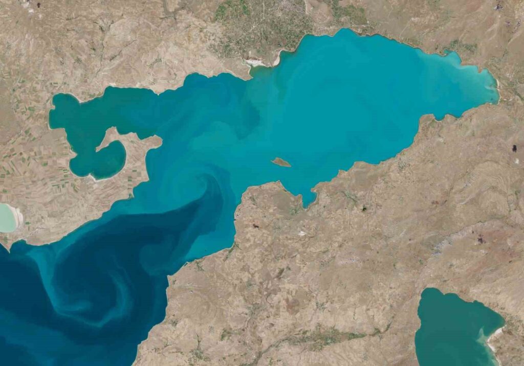
The European Space Agency has captured images of the strong currents in Lake Van.
The European Space Agency (ESA) Sentinel-2 L2A satellite has captured detailed images of the strong current systems on the surface of Lake Van. The photos taken by ESA’s Sentinel-2 L2A satellite on October 27 show…

The European Space Agency (ESA) Sentinel-2 L2A satellite has captured detailed images of the strong current systems on the surface of Lake Van.
The photos taken on October 27 by ESA’s Sentinel-2 L2A satellite reminded viewers of the image of Lake Van taken by NASA astronaut Kate Rubins, which made waves worldwide. Just like in NASA’s image, the new satellite photos captured by ESA also clearly show the currents on the lake’s surface. Lake Van, with an area of 3,712 square kilometers, is the largest soda lake in the world, and the currents created by the combination of freshwater and soda water under the influence of winds create unique patterns reminiscent of marbling art in the lake.
“Like the work of a marbling artist”
Speaking to IHA, Dr. Mustafa Akkuş, a faculty member at the Van Yüzüncü Yıl University Fisheries Faculty, stated that Lake Van has a unique ecosystem worldwide due to its soda structure. He pointed out that the increase in freshwater currents and the movement of winds on the surface result in the waters of the lake being mixed. Akkuş stated that as a result of the combination of soda water and freshwater, sediments form in the lake, saying, “The similar landscapes we remember from the photo taken by the astronaut at NASA are now also present in the Sentinel-2 L2A satellite images dated October 27 from the European Space Agency (ESA). The currents are like the work of a marbling artist, displayed in all their details.”
“There are very strong current systems in the lake”
Highlighting that Lake Van is a lake with strong current systems, Akkuş continued his remarks: “With an area of 3,712 square kilometers, it forms the largest soda lake in the world. Therefore, there are very strong current systems in the lake. Especially in this season, the lines of these currents are directly reflected in satellite images.”


